


Planning services are critical to our multidisciplinary and integrated project delivery approach. Our services support both private and public sector clients and municipal, provincial, and federal agencies. JLR advises on land use and interprets the regulations and policies that govern it. We also provide master planning, concept development, mapping, and studies to facilitate ongoing operations and accommodate growth.
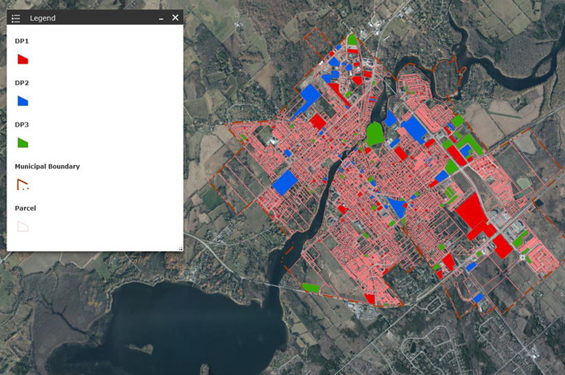
JLR uses a cloud-based geographic information system (GIS) program that eliminates the need for municipalities to invest in equipment and programs of their own. Using GPS-enabled devices, customizable web mapping applications, and detailed GIS data, our team can create purpose-built maps of key assets that collect site-specific data all in one place.
JLR’s Municipal Infrastructure group supports municipal projects by helping clients navigate policy and regulatory standards and preparing bylaw reviews, municipal planning, assessments, applications, official plans, and zoning amendments to push plans forward successfully.
Reference Projects


Learn more about our dedicated Municipal Infrastructure & Planning team and their incredible breadth of expertise in providing specialized solutions for diverse clients.
Back to Municipal Infrastructure & Planning